
搜索结果: 1-15 共查到“测绘科学技术 MAP”相关记录202条 . 查询时间(0.078 秒)
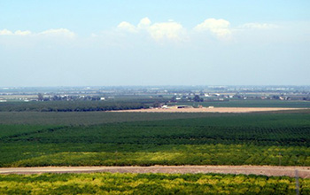
Researchers use satellite imaging to map groundwater use in California's Central Valley(图)
satellite imaging map groundwater California Central Valley
2020/10/16
Researchers at the University of California, San Diego report a new way to improve groundwater monitoring by using a remote sensing technology, known as InSAR (interferometric synthetic aper...
1D-2D MODELING OF URBAN FLOODS AND RISK MAP GENERATION FOR THE PART OF HYDERABAD CITY
Stormwater Urban Flood Modeling Zone XIII SWMM PCSWMM
2019/2/27
Space for water is now becoming guiding principle of urban planning because urban flooding is the major problem facing by most of the cities in India. Urban development in developing countries like In...
A USABILITY EVALUATION OF A 3D MAP DISPLAY FOR PEDESTRIAN NAVIGATION
Pedestrian Navigation LOD 3D 2D Usability
2018/11/9
This paper is focused to address the map display usability for finding given POI addresses in a popular urban city area. LOD 1 of 3D representations of city buildings are presented into a 2.5D map for...
THE LANDSLIDE HAZARD MAP OF BOGOTA AN UPDATING
Landslides Bogota GRASS GIS Risk management Modelling Model Builder
2018/11/8
A land management plan (Plan de Ordenamiento Territorial, POT) is an instrument for planning the land-use of a territory considering physical, social and economic aspects. In the frame of the POT’s up...
IMPROVING PATH QUERY PERFORMANCE IN PGROUTING USING A MAP GENERALIZATION APPROACH
pgRouting Road Networks Skeletal Model Skeleton Shortest Path Map Generalization Zones Path Computation
2018/11/8
pgRouting library provides functions to compute shortest path between any two points of a road network which is of great demand and also a topic of interest in the field of GIS, graph theory and trans...
THE METHOD OF MULTIPLE SPATIAL PLANNING BASIC MAP
Multiple Spatial Planning Planning Basic Map Spatial Basic Coordinate system Land use classification Geographical Conditions
2018/5/16
The “Provincial Space Plan Pilot Program” issued in December 2016 pointed out that the existing space management and control information management platforms of various departments were integrated, an...
MASHUP SCHEME DESIGN OF MAP TILES USING LIGHTWEIGHT OPEN SOURCE WEBGIS PLATFORM
CesiumJS Tilling Scheme Localized Deployment Spatial Data Organization WebGIS
2018/5/14
To address the difficulty involved when using existing commercial Geographic Information System platforms to integrate multi-source image data fusion, this research proposes the loading of multi-sourc...
APPLYING RANDOM FOREST CLASSIFICATION TO MAP LAND USE/LAND COVER USING LANDSAT 8 OLI
Classification Landsat 8 OLI Land use Land cover Random Forest Decision Tree
2018/5/8
This study used the Random Forest classifier (RF) running in R environment to map Land use/Land cover (LULC) of Dak Lak province in Vietnam based on the Landsat 8 OLI. The values of two RF parameters ...

In Guam, researchers developed a method for mapping underwater areas that is transforming how oceanographers observe the seafloor. Data from global positioning satellites are the primary method for ma...
CHALLENGES AND OPPORTUNITIES: ONE STOP PROCESSING OF AUTOMATIC LARGE-SCALE BASE MAP PRODUCTION USING AIRBORNE LIDAR DATA WITHIN GIS ENVIRONMENT. CASE STUDY: MAKASSAR CITY, INDONESIA
Automation LiDAR Processing Base Map Production GIS Accuracy Assessment
2017/7/12
LiDAR data acquisition is recognized as one of the fastest solutions to provide basis data for large-scale topographical base maps worldwide. Automatic LiDAR processing is believed one possible scheme...
UNCERTAINTY ASSESSMENT AND WEIGHT MAP GENERATION FOR EFFICIENT FUSION OF TANDEM-X AND CARTOSAT-1 DEMS
Accuracy assessment Data fusion Predicted weight map Artificial Neural Network TanDEM-X DEM Cartosat-1 DEM
2017/7/13
Recently, with InSAR data provided by the German TanDEM-X mission, a new global, high-resolution Digital Elevation Model (DEM) has been produced by the German Aerospace Center (DLR) with unprecedented...
FEATURE ORIENTATION AND POSITIONAL ACCURACY ASSESSMENT OF DIGITAL ORTHOPHOTO AND LINE MAP FOR LARGE SCALE MAPPING: THE CASE STUDY ON BAHIR DAR TOWN, ETHIOPIA
Orthophoto Line map GPS data Positional Orientation Accuracy
2017/7/12
This study used in-situ GPS data to validate the accuracy of horizontal coordinates and orientation of linear features of orthophoto and line map for Bahir Dar city. GPS data is processed using GAMIT/...
FROM THE ROAD SIGN TO THE MAP: 3D MODELING IN SUPPORT OF THE URBAN AND RURAL ROAD CONDITIONS
aerial photogrammetry points cloud road sign drone UAV
2017/6/20
Unmanned Aerial Vehicles (UAV), commonly known as a drone, and an Unmanned Aircraft Systems (UAS) have been spreading on a massive scale during the last few years, especially for civilian use. And thi...
ESTIMATION OF STAND HEIGHT AND FOREST VOLUME USING HIGH RESOLUTION STEREO PHOTOGRAPHY AND FOREST TYPE MAP
Stand Height Forest Volume normalized DSM Aerial Photo
2016/11/30
Traditional field methods for measuring tree heights are often too costly and time consuming. An alternative remote sensing approach is to measure tree heights from digital stereo photographs which is...
ACCELERATION OF TOPOGRAPHIC MAP PRODUCTION USING SEMI-AUTOMATIC DTM FROM DSM RADAR DATA
Automatic DTM Classification Topographic Map
2016/11/23
Badan Informasi Geospasial (BIG) is government institution in Indonesia which is responsible to provide Topographic Map at several map scale. For medium map scale, e.g. 1:25.000 or 1:50.000, DSM from ...