
�������: 1-15 ���鵽��������ͼ��������ѧ������ؼ�¼177�� . ��ѯʱ��(0.407 ��)
������������Ϣ��
���� ��������Ϣ�� ��̬��
2023/11/13
������������Ϣ�֣�����ʡ��������Ϣ�֣�������1957�꣬��Ϊ��Ȼ��Դ���ɳ�������ʵ������Ȼ��Դ��������ʡ����˫���쵼����Ȼ��Դ��Ϊ���Ĺ������ƣ�����ʡ��������Ȩί�У���ʹ����ʡ��������Ϣͳһ�������ְ�ܡ�������������Ϣ����ȫ����Ҫ�IJ�������Ϣ���������л��أ��е�����֯Э����Ȼ��Դ������Ĺ��һ�����桢Ӧ������Լ�����ȫ���Ի��ش��������Ϣ��Ŀ��ʵʩ���е�����֯Э����Ȼ��Դ���������Ȼ��...
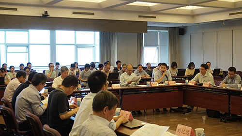
�й���ѧԺA���ȵ�ר���̬�����������ͼ��������Ӧ��ʾ�����������ھ��ٿ���ͼ��
�й���ѧԺ ��̬�������� ����ͼ������ ������ ��������ݿ�ѧ
2019/5/16
2019��5��12�գ��й���ѧԺA��ս�����ȵ��Ƽ�ר������й���̬��������Ƽ����̡������¼�ơ������й���ר���Ŀ10����̬�����������ͼ��������Ӧ��ʾ�������������й���ѧԺ������ѧ����Դ�о����ٿ����������ɵ�����Դ��������ר����ϯ��ѧ�Ҹ�ȫʤ�о�Ա����Ŀ10������½���о�Ա���֡���������ѯר��������ʦ����ѧ���������ڡ�����ʡ��̬��������Ϣ���Ŀ��������Ρ�������ѧ��褽��ڡ��п�Ժ�Ƽ�ս����ѯ...
GOPLUS GEOSPATIAL DATA SERVICE FOR INDUSTRIAL AND INFRASTRUCTURE DEVELOPMENT IN ODISHA, INDIA
GOPLUS Land Bank Ortho image Web-GIS Geospatial data Geocoded data RoR (Record of Rights)
2019/2/27
Technological advancement is the key driver for economic growth and sustainable development. Geospatial Technologies applications and tools available today are being used for improved performance of a...
2018��11��5�գ��й���У�Ƽ��ڿ��о��ṫ����2018���ȫ����У���ܳ����ټѡ�����Ƽ��ڿ�����ѡ�����ɽ����ѧ�Ƽ��ڿ���༭����ġ�ɽ����ѧѧ������ѧ�棩������Ϊ���й���У�ټѿƼ��ڿ�������ɽ����ѧѧ����ҽѧ�棩����ɽ����ѧѧ������ѧ�棩����ɽ����ѧ���Ǻ���ѧ��������Ϊ���й���У����Ƽ��ڿ��������������Ƽ��ڿ������Χ��ѧУ��˫һ�������裬�Դ���������ǿ�硱ΪĿ�꣬����ı����չ��ͼ��ʵʩ����...
GEOSPATIAL APPROACH FOR LANDSLIDE ACTIVITY ASSESSMENT AND MAPPING BASED ON VEGETATION ANOMALIES
Tropical rain forest Landslide activity egetation anomalies
2018/11/9
Remote sensing has been widely used for landslide inventory mapping and monitoring. Landslide activity is one of the important parameters for landslide inventory and it can be strongly related to vege...
�й�ʯ�ʹ�ѧ��������2019��˶ʿ�о�����ѧ�������������ֲ�ͼԭ���뷽�����Դ��
�й�ʯ�ʹ�ѧ ���� 2019�� ˶ʿ�о��� ��ѧ���� ������ ���ֲ�ͼԭ���뷽�� ���Դ��
2018/10/16
�й�ʯ�ʹ�ѧ��������2019��˶ʿ�о�����ѧ�������������ֲ�ͼԭ���뷽�����Դ�١�

��ӭ��,���ϴ�ѧ�������ѧ����Ϣ����ѧԺ�����ң�п�ѧϵ������,2007/07 - �������ϴ�ѧ�������ѧ����Ϣ����ѧԺ������,1993/09 - 2007/07���������ĿƼ�ѧԺ��Ӧ����ѧϵ��������,1981/12 - 1990/09�������۶����������ӵ�ѧУ����Ա��
GEOMATICS MAPPING OF NATURAL HAZARDS: OVERVIEW AND EXPERIENCES
Rapid Mapping Multi-temporal Geomatics Platform Sensor Landslide Mudflow Time management
2018/5/8
This paper reviews the major Geomatics solutions available on the market and explores their potentialities for rapid disaster assessment applications. The attention is primarily focused on the most re...

�й���ѧԺ�½���̬������о���������ǿӦ����ϯ����ʱ���ش�ѧ200����У�죨ͼ��
��ǿ 200����У�� ���ʲ���ʵ���� ��ͼ����ͼʵ���� �綴ʵ����
2017/3/28
2017��3��21��25��, �й���ѧԺ�½���̬������о���������ǿ�о�Աһ��Ӧ����ʱ���ش�ѧУ��Anne De PaepeŮʿ�����룬������ʱ�μ��˸��ش�ѧ��У200����У������������29������68����ѧ���о�������120����������ϯ��У����̳����ף�������ŷ�����»᳣����ϯ�ն�����������������ϯ��̳��Ļʽ������ּ���ԡ�
The 5th International Workshop on Web Mapping,`Geoprocessing and Services
The 5th International Workshop Web Mapping,Geoprocessing and Services
2017/3/10
WebMGS is an important event in the field of web-based GIS, which emphasizes a diverse range of topics related to new web-based developments of geospatial theories, technologies and solutions. The Web...
THE EFFECT OF UNDERWATER IMAGERY RADIOMETRY ON 3D RECONSTRUCTION AND ORTHOIMAGERY
Underwater 3D Reconstruction Underwater Image Enhancement
2017/4/5
The work presented in this paper investigates the effect of the radiometry of the underwater imagery on automating the 3D reconstruction and the produced orthoimagery. Main aim is to investigate wheth...
USING LANDSAT 8 IMAGE TIME SERIES FOR CROP MAPPING IN A REGION OF CERRADO,BRAZIL
Crop mapping Landsat Time series Random Forest algorithm
2016/12/1
The objective of this research is to classify agricultural land use in a region of the Cerrado (Brazilian Savanna) biome using a time series of Enhanced Vegetation Index (EVI) from Landsat 8 OLI. Phen...
WETLAND MAPPING WITH SAR/QUAD-POL DATA ACQUIRED DURING TANDEM-X SCIENCE PHASE
TanDEM-X wetland mapping Quad-Pol Alt-Pol
2016/11/24
The aim of this study was to exploit fully polarimetric SAR data acquired during TanDEM-X �C Science Phase (2014/2015) over herbaceous wetlands of the Biebrza National Park (BbNP) in North-Eastern Pola...
ATMOSPHERIC CORRECTION,REFLECTANCE CALIBRATION AND BRDF CORRECTION FOR ADS40 IMAGE DATA
Multispectral Modelling Aerial Calibration Land Use Mapping Atmosphere Radiometry Correction
2015/12/30
A new radiometric workflow for ADS40 line scanner data has been developed and implemented. It includes now two additional atmospheric correction algorithms and an empirical BRDF correction. Both atmos...
Towards Autonomous Mars Rover Localization: Operations in 2003 MER Mission and New Developments for Future Missions
Absolute Orientation Bundle Adjustment Close Range Photogrammetry
2015/11/23
Towards Autonomous Mars Rover Localization: Operations in 2003 MER Mission and New Developments for Future Missions.
�й��о����������а�-��
- ���ڼ���...
�й�ѧ���ڿ����а�-��
- ���ڼ���...
�����ѧ���л������а�-��
- ���ڼ���...
�й���ѧ���а�-��
- ���ڼ���...
�ˡ���-ƪ
- ���ڼ���...
�Ρ���-ƪ
- ���ڼ���...
��������-ƪ
- ���ڼ���...
�������� -ƪ
- ���ڼ���...
֪ʶҪ��-ƪ
- ���ڼ���...
���ʶ�̬-ƪ
- ���ڼ���...
��������-ƪ
- ���ڼ���...
ѧ��ָ��-ƪ
- ���ڼ���...
ѧ��վ��-ƪ
- ���ڼ���...