
搜索结果: 1-15 共查到“知识库 地图设计与编绘”相关记录97条 . 查询时间(4.356 秒)
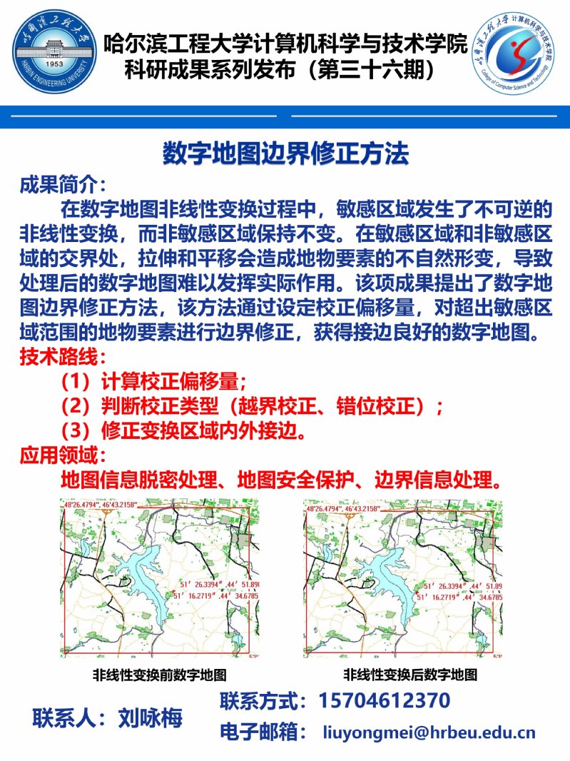
哈尔滨工程大学计算机科学与技术学院科研成果系列发布(第三十六期)。
MAPPING RICE CROPPING SYSTEM IN THE LOWER GANGETIC PLAIN USING LANDASAT 8 (OLI) AND MODIS IMAGERY
Department of Geography and Environment Vidyasagar University Midnapore India
2019/2/27
The Indo-Gangetic basin is one of the productive rice growing areas in South-East Asia. Within this extensive flat fertile land, lower Gangetic basin, especially the south Bengal, is most intensively ...
为实现移动机器人环境探知并直观表现的功能,设计一种以前方180°为范围的简单几何地图绘制系统。该系统采用lpc1768 为核心,下位机部分以小型舵机MG90S 和超声模块HC-SR04 的云台组合为基础,上位机通过CVI 编写的程序对下位机测量的数据进行处理,将其通过上位机界面以二维地图形式直观表现;并通过探测3 种障碍地图进行验证。实验结果表明:该系统能准确反映机器人前方的环境信息,适用于移动机...
AUTOMATIC ROAD SIGN INVENTORY USING MOBILE MAPPING SYSTEMS
Mobile Mapping System Point cloud segmentation Road sign inventory Image processing Classification
2016/7/28
The periodic inspection of certain infrastructure features plays a key role for road network safety and preservation, and for developing optimal maintenance planning that minimize the life-cycle cost ...
FAST DRAWING OF TRAFFIC SIGN USING MOBILE MAPPING SYSTEM
Traffic Sign Fast Drawing Coarse Prediction Mobile Mapping System (MMS)
2016/7/28
Traffic sign provides road users with the specified instruction and information to enhance traffic safety. Automatic detection of traffic sign is important for navigation, autonomous driving, transpor...
Multi-image matching in object space on the basis of a general 3-D surface model instead of common 2.5-D surface models and its application for urban scenes
Surface Reconstruction Matching 3-d Surface Models Object Space
2016/5/23
A new method for high resolution surface reconstruction by multi-image matching in object space is formulated with regard to the integration of a general 3-d surface model in object space, because com...
Generation for 3D view map using polygon shift method
Polygon Shift Method bird’s eye view shadow depth distance
2016/5/20
The authors have developed a new method called "Polygon Shift Method" (named by the first author) that enables to generate bird's eye view of topographic landscape with shade and shadow. The Polygon S...
The design and development of a Geological Hypermap Prototype
design development Geological Hypermap Prototype
2016/5/20
A geologic map provides information about the currently accepted model regarding the subsurface structures in a given area. It is based on various types of information such as field observations, dril...
The estimation of accuracy of thematic maps derived from remotely sensed data used in conjunction with a geographic information system is presented. A systematic random sampling techique is proposed t...
Analysis of software requirements to represent urban areas with DEMs and 3D visualization of buildings and structures
DEM (Digital Elevation Models) Visualization of 3D DSM (Digital Surface Modeling)
2016/5/20
In order to have an integrated view of an urban area, it is necessary to show the terrain and the structures on it. There are many established computer programs that can do efficiently either task ind...
Virtual reality applications in the context of urban planning presume the acquisition of 3D urban models. Photo realism can only be achieved if the geometry of buildings is represented by a detailed a...
为实现移动机器人环境探知并直观表现的功能,设计一种以前方180°为范围的简单几何地图绘制系统。该系统采用lpc1768为核心,下位机部分以小型舵机MG90S和超声模块HC-SR04的云台组合为基础,上位机通过CVI编写的程序对下位机测量的数据进行处理,将其通过上位机界面以二维地图形式直观表现;并通过探测3种障碍地图进行验证。实验结果表明:该系统能准确反映机器人前方的环境信息,适用于移动机器人的实时...
Econova Flood Warning System: Geo-Information for Real Time Flood Risk Management
Hydrology Flood Forecasting Time Series Watershed Modeling
2015/12/18
Natural disasters engendered by climate change and global warming have created an unprecedented need for intervention from local governments. Recently, a US senatorial sub-committee on disaster predic...
Research on Spatial Database Model Under Grid Computing Environment
Grid Spatial Database Model Work Flow Simulation Experiment
2015/12/18
The paper firstly introduces grid technology and spatial database. Secondly it has designed the spatial database model in grid environment, which contains Application layer, Collective Layer and Fabri...
Digital Mapping Using Aerial Digital Camera Imagery
Aerial Digital Camera Photogrammetry Accuracy Analysis Mapping Digital Map
2015/12/17
Lately, photogrammetry using aerial digital camera has been utilized widely in the fields of a plan, development and management for a national land in advanced countries. There are various benefits us...