
搜索结果: 1-5 共查到“海洋测绘 GPS”相关记录5条 . 查询时间(0.157 秒)
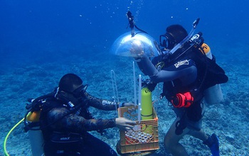
In Guam, researchers developed a method for mapping underwater areas that is transforming how oceanographers observe the seafloor. Data from global positioning satellites are the primary method for ma...
DETERMINATION OF OCEAN DATUM USING GPS BUOY OBSERVATION DATA
Ocean's vertical datum GPS buoy Tidal gauge
2015/12/28
The 37% of worldwide population lives in near coastal area have effect on serious damage a sort inundation and tsunami caused by sea level rise. The importance of monitoring sea level rise is evidence...
MONITORING OF LANDSLIDES WITH MASS MARKET GPS: AN ALTERNATIVE LOW COST SOLUTION
Low cost GNSS Virtual RINEX Network RTK deformation monitoring
2014/4/24
The territory of Italy is seriously afflicted by hydrological risk, with 82% of its area affected by this phenomenon.
In recent years, technologies and advanced research have played an important role...
14 YEARS OF GPS TROPOSPHERIC DELAYS IN THE FRENCH-ITALIAN BORDER REGION: A DATA BASE FOR METEOROLOGICAL AND CLIMATOLOGICAL ANALYSES
Climate Databases Geodesy Meteorology Monitoring International Networks GPS
2014/4/24
GPS data from 181 permanent stations extracted from different networks covering France and the Italian part of the Alps are used to
estimate a homogeneous set of tropospheric parameters over 14 year...