
�������: 106-120 ���鵽����ز�����������ؼ�¼613�� . ��ѯʱ��(0.478 ��)
Mosaicking of Digital Elevation Models derived by SAR interferometry
Mosaicking Digital Elevation Models derived SAR interferometry
2016/5/20
In the framework of the Shuttle Radar Topography Mapper (SRTM) Mission the generation of high-quality Digital Elevation Models (DEMs) with global coverage of the earth's surface is envisaged. In this ...
Data interchange: Helping to survive existing transfer standards
Spatial Data Access Interchange Point Data Vector Data
2016/5/20
Exchange of data between different software/hardware systems has traditionally involved porting data directly from System A to System B. With large numbers of systems, this tradition has created very ...
Land cover classification: Some new techniques, new source data
Environmental variables Global Land Cover AVHRR Satellite Imagery
2016/5/20
Land cover classifications have advanced from using single Landsat Multispectral Scanner scenes to using "full resolution" AVHRR time series. Three current approaches to global land cover study with A...
Development & assessment of the global land one-km base elevation Digital Elevation Model (GLOBE)
Environmental variables Global Database Topography
2016/5/20
The Global Land One-kilometer Base Elevation (GLOBE) digital elevation model is the most thoroughly designed, reviewed, and documented global digital elevation dataset to date. GLOBE was developed by ...
High resolution digital terrain models of shallow lake basins - Towards modelling dynamics of sedimentation for multithematic ecosystems research
High resolution digital terrain models shallow lake basins Towards modelling dynamics sedimentation multithematic ecosystems research
2016/5/20
Research on GIS applications in the real world context has to be strengthened besides developing GIS application software itself. An ecologically important field of applications is the integration of ...
Updating topographic databases with ARC INFO; client fitted creation of change-only information
topographic databases ARC INFO change-only information
2016/5/20
Most of the existing change-only solutions for updating topologically structured, topographic databases only work in ideal conditions. We therefore decided to develop a new procedure that would also b...
Integrated access to the many heterogeneous and distributed sources of Geo data is an important precondition in order to facilitate the investigation of global processes like temporal development of e...
Ӣ������Ȼ����־���չ�����һƪ����ѧ���ģ�������һ����Яʽ���ͳɱ��������ǣ��ɲ�������������ص�ʯ�͵Ⱦֲ�С�����Ŷ����������豸���жȻ����Բ�������ij�ϫ����Ӧ���ڵ����ѧ�����̡�ʯ�ͺ���Ȼ����̽�ͻ�������ϡ�������ȫ��Ϊ�������ٶ��ǣ����ڲ��������������ٶ��е�С�仯���ڿ�ѧӦ���ϣ����ԶԵؿ��α���й۲⣬�����ڻ�ɽѧ�У��������ܹ��ڻ�ɽ�緢ǰ������ɽ���ҽ��ѻ��̶ȣ����������ڹ�ҵ����ҵ�ϵ�...
2016��2��28�գ��ܹ��ҷ���ίί�У��й����ʹ�����ѯ��˾�ڱ����ٿ������������������ش�Ƽ�������ʩ��Ŀ�������о����������ᡣ����ר�����ɾ����������������ͼ��������ʲ�桢�����������������̡��������ú��̹����ȷ����12λר����ɣ�������Ȼ��ѧ����ί��������Ժʿ���鳤����Ŀ���ܲ��Ž������Ƽ�˾˾�����Ӿ������ҷ���ί������ʡ���人�з���ί����쵼����Ŀ���˵�λ��УУ�������ơ���У������������Ŀ��...
һ�ֻ�������ģ�͵�ͼ��λϵͳ
ͼ��λ ���������ģ�� ��ά�ؽ� λ��ͼ�Ż� ȫ�����
2017/1/16
ͼ��λ��������ʵ���й㷺��Ӧ�ã��絼����·���滮��������ʵ��.�����û����ԣ�ֻ������һ��ͼ��ʵ�ֶ�λ.���������һ�ֻ������������ģ�͵�ͼ��λϵͳ��������������ģ�͵���ά�ع��㷨�ͻ���λ��ͼ�Ż���ͼ��λ����.�������ά�ع��㷨��������ģ�͵����ڼ������ʣ��ܹ�����ȫ�������۵ȹ�������ģ�ͣ����Ͳɼ����ع��Ĵ��ۣ������ع���Ч��.����λ��ͼ�Ķ�λ�����ں���ͼ�������ƥ�����Ϣ��ͼ������λ��...
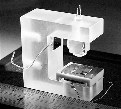
���õ���Ƶ�ܹ������һ��0.18��m CMOS���յ�GPS/BDS˫ģ���ع����ջ���Ƶǰ�ˣ�����GPS L1ģʽ��BDS B1ģʽ�¹�����ͨ��Ƶ������Ӧ��·������Ƶ�˲�����ʱ�䳣��,������Ƶ�ʲ�ȷ���ȣ�ѹ�������м���4λ���ص������У������Ƶ�ʵ�г��Χ����λ�������ܣ�ͨ��Ӳ�����õķ�ʽ����ϵͳ���ġ����Խ����������1.8 V��Դ��ѹ�£�����37.8 mW����ѹ����Ϊ103 dB��GPS L1��B...
Case Study�CUse of Video Clips in a Virtual Learning Environment to enhance the learning experience of our students
Video clips student centred learning multi layered teaching enhanced student experience student opinions
2016/1/29
This paper considers how the use of video clips integrated into a virtual learning environment has been perceived by students on a land surveying module within a civil engineering degree. The increasi...
2016��1��3�գ����пƼ���ѧ��֯�ٿ��������������о���ʩ�����ش�Ƽ�������ʩ��Ŀ�������о�����ר��Ԥ��ᡣ�������Ƽ�˾˾�����Ӿ�����Ŀָ�ӳ������пƼ���ѧУ�������ƣ���Ŀ��ָ�ӳ�������ǡ���У����С�࣬��Ŀ��ϯ��ѧ����Ժʿ��ϯ���顣��������Ŀ����ָ�ӳ�����У�����������֡�

2015��12��28�գ��������������ѧ����ϵϵ���������ǽ�������У���з��ʣ���У����ҫ�����л�������ǣ������ѧ���湤��ѧԺ���ʺ����뽻������ظ����˲μ��˻�̸��
ESTIMATION OF THE ACCURACY OF THE SRTM TERRAIN MODEL ON THE AREA OF POLAND
SAR Interferometer DEM/DTM Reference Data Statistic Accuracy Analysis
2015/12/30
In order to determine the absolute accuracy of SRMT model on Polish area the research work has been performed on the basis of reference terrain profiles measured by GPS technique. The flat and hilly t...
�й��о����������а�-��
- ���ڼ���...
�й�ѧ���ڿ����а�-��
- ���ڼ���...
�����ѧ���л������а�-��
- ���ڼ���...
�й���ѧ���а�-��
- ���ڼ���...
�ˡ���-ƪ
- ���ڼ���...
�Ρ���-ƪ
- ���ڼ���...
��������-ƪ
- ���ڼ���...
�������� -ƪ
- ���ڼ���...
֪ʶҪ��-ƪ
- ���ڼ���...
���ʶ�̬-ƪ
- ���ڼ���...
��������-ƪ
- ���ڼ���...
ѧ��ָ��-ƪ
- ���ڼ���...
ѧ��վ��-ƪ
- ���ڼ���...